Brimexur
-----
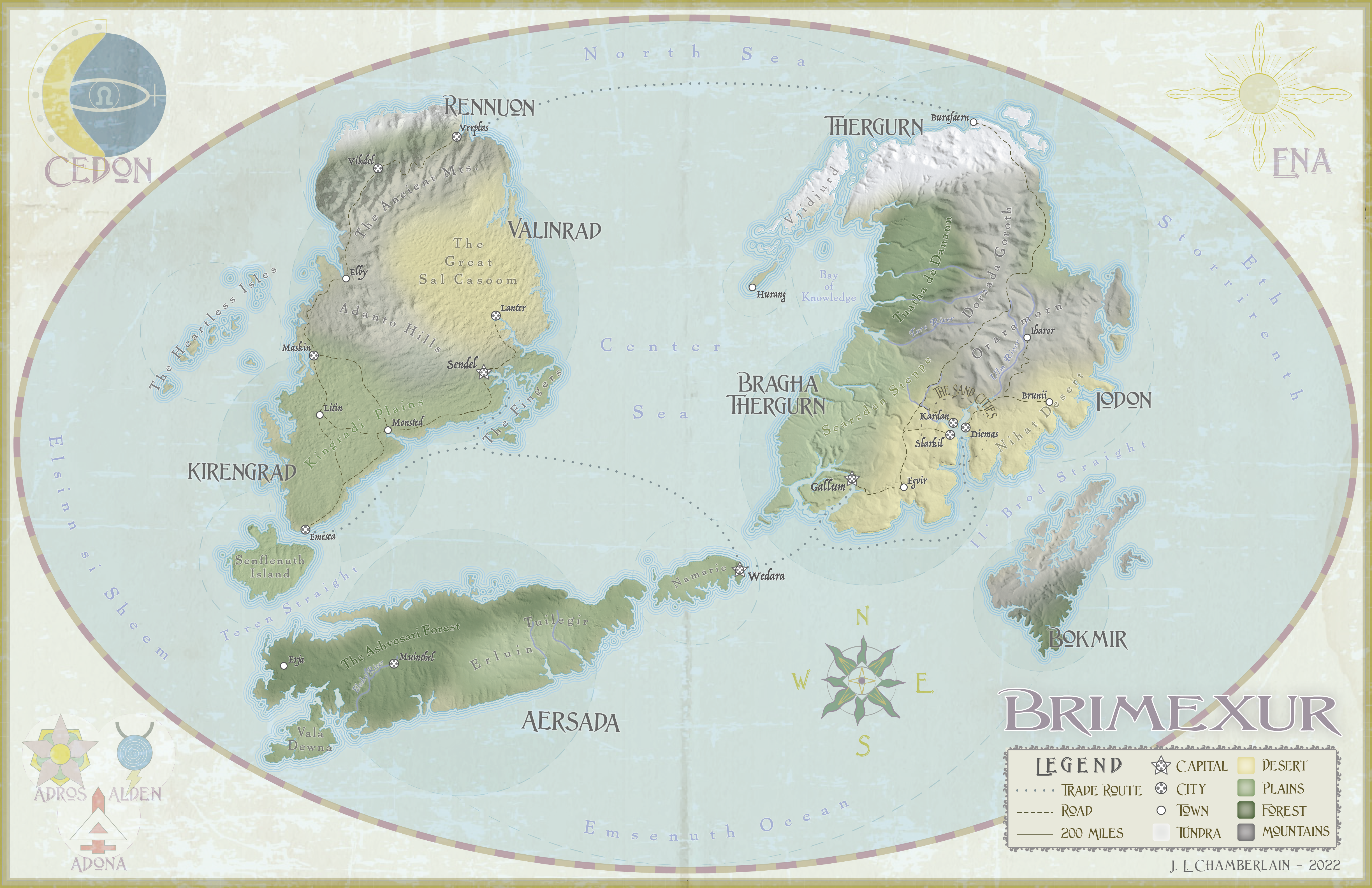
I had a lot of fun making this map for my friend Erin to use in her D&D campaigns that she runs in
her world that she created.
She provided me with all the place names, lore, and a sketch of the shape of the continents. I used
a DEM to create new realistic landforms and hillshades.
I drew all the symbols around the edges and north arrow by hand, then scanned and traced them in
Illustrator. The DEMs were manipulated in ArcGIS Pro and the design work and styling was all
accomplished in Adobe Illustrator.
I think the result is a map that feels at the same time hyperrealistic and antique. A fun effect!
This was created for an assignment in Geography 370 - Intro to Cartography - UW-Madison.
-----